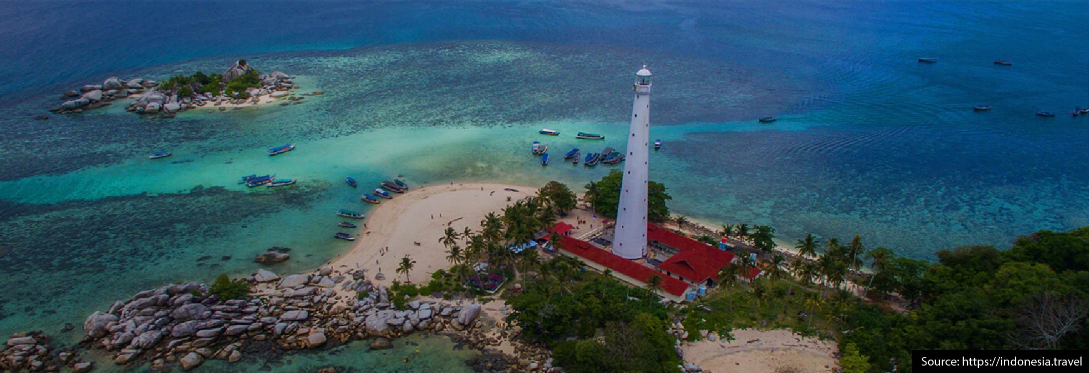
BANGKA BELITUNG
STORY ABOUT BANGKA BELITUNG
Bangka Belitung island is a province with archipelago nomenclature. Broadly regional entirely 81,725,14 sq.km. land with width is 16,424,14 sq.km. and wide territorial water of rock. Consist of 2 big islands, Bangka Island and Belitung Island and also 254 islets surrounding them with coastal length is 1,200 s.km. divided in 7 sub-provinces. With excellence of comparability and supported by regional ecosystem of archipelago, coastal area and the island with the other, Bangka Belitung present marine tourism (diving, scuba, snorkeling, fishing and sailing). There are approximately 55 Chinese or Buddhist temples on Bangka alone which are still in use. The Chinese make at least 20% of the population of Babel. The majority of the Chinese are direct descendants of the coolies who worked the tin mines. The oldest temple is in Batu Rusa, a village along the road from Pangkalpinang to Sungai Liat. A beautifully decorated temple is found near Tayu in the north of Bangka Island.
PLACES OF INTEREST
1) BELITUNG ISLAND
Belitung island has stayed natural and unspoilt. Coming here is a bit of an adventure where the tourist has to be more self-sufficient and adaptable. Visitors have to come prepared, bring things like swimwear, diving equipment, medicines, cosmetics, sunglasses and sun cream.
2) TANJUNG PANDA
Tanjung Pandan is the capital city on Babel. The topography consists of lowland and some small areas of swamp while in the middle part there is highland in groups of 150-200 meters above the sea level. It is the second biggest tin producer in Indonesia.
3) MANGGAR
Manggar is about 90 km from Tanjungpandan. The main economy activity in Manggar was tin mining. There are many nice places that can be visited like: Serdang beach, Burung Mandi beach, Malang Lepau beach, Pengepangan beach, Tirta Surya Natural swimming pool, Payak Lake, Kwan In Chinese temple.
4) MATRAS & PARAI TENGGIRI BEACHES
Matras and Parai Tenggiri Beaches in the northeast of Bangka, 48 km from Pangkal Pinang and 12 km from Sungai Liat. The beach is about 3 kilometers long and its width is almost 20 meters. Parai, a beach set between rocky capes is an ideal location for relaxing and swimming. Local fishermen moor their vessels here after a day of fishing, giving the beach the picturesque feel of a fishing village.
5) MOUNT MENUMBUNG
Mount Menumbung (355 m) a rather high hill in the neighbourhood of Mentok (North West Bangka) stands as a memorial to the history of the Indonesian nation. A guest house whish was built here by the Dutch in 1932 was used to house the former President Soekarno and Vice-President Hatta during their imprisonment from February to July 1949.
6) REMODONG BEACH
Remodong Beach in north Bangka is a favourite place to enjoy the sunset as the beach faces the west. Tourist facilities are also available on this beach.
7) BANGKA
The name Bangka is derived from the word “WANGKA”, which means tin. This word was also written in a Sriwijaya stone inscription dated 686 AD and discovered near the town of Kota Kapur in West Bangka. Today this inscription is kept in the National Museum in Jakarta. Bangka is the main tin producer in Indonesia and is also well-known for its white pepper. The group of islands making up the Babel Province is almost located on the equator with latitude of 1 degree 30 to 3 degree 07 and longitude of 105 to 107 degrees east.
SOURCE:
- Image: https://indonesia.travel
- Info: IMT-GT Tourism Book by Ministry of Tourism and Sport Thailand